GNSS jamming and spoofing are no longer niche concerns — they disrupt ships, flights, and critical infrastructure worldwide. Here is how C/N0, AGC, CRPA antennas, and multi-sensor fusion help you recognize and localize interference.
What Are GNSS Jamming and Spoofing?
GNSS satellites sit about 20,000 km above us, and by the time their signals reach the ground they're incredibly faint — which makes them easy to drown out or copy with stronger signals from the ground. That one fact explains both of the main threats. Jamming just blasts loud radio noise across the GNSS frequencies in the L-band (1–2 GHz, so L1, L2, and L5), and the receiver can't lock onto enough satellites to work out where it is. To get a full 3D fix plus a time correction, a receiver needs at least four satellites; for 3D position alone, three will do.
Spoofing is a trickier beast. Instead of drowning out the real signals, it mimics them, feeding the receiver fake data that leads it to calculate the wrong position or time. Since spoofing takes more technical sophistication than jamming, a simple signal-strength check usually won't catch it. And the stakes here are enormous — the European Space Agency puts about 10% of European GDP as dependent on satellite navigation. Think about the timing side too: a GNSS receiver delivers accuracy around 2 nanoseconds, while internet-based synchronization sits at roughly 2 milliseconds. That gap is not small.
How to Detect GNSS Interference Using C/N0 and AGC
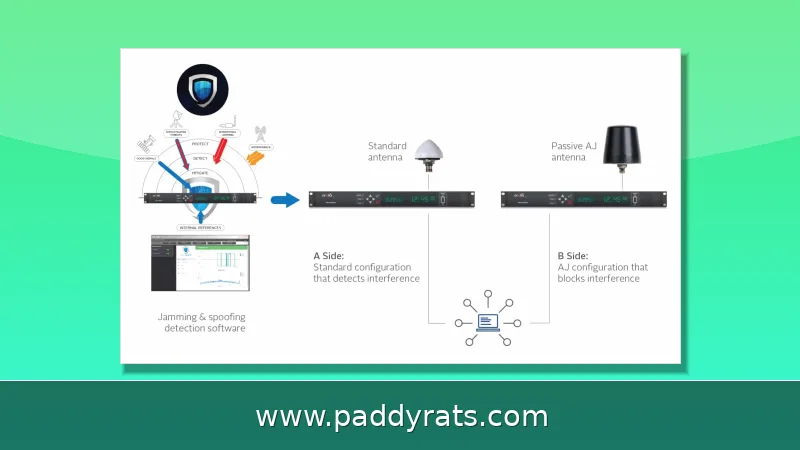
The easiest way to spot interference is by watching two receiver metrics: carrier-to-noise ratio (C/N0) and automatic gain control (AGC). When someone is jamming, the background noise level goes up, so C/N0 falls and AGC dips along with it. Spoofing looks a little different — a fake signal is strong enough to push C/N0 upward, but AGC still drops, since the receiver's front end is now dealing with more total power than it should be. If you see both values shift at the same time, that's a pretty solid sign something is interfering, and it's the same basic logic that automated checks in tools like the GnssLogger Android app rely on.
GnssLogger's jamming check isn't all that complicated, really. It takes the average C/N0 and AGC values from the last 10 epochs and compares them to the previous 50. If both drop at the same time, that's your jamming flag. The spoofing check goes the other way: it watches for C/N0 climbing while AGC falls, and it also cross-checks your device's GNSS time against an NTP server. If those two times drift apart by more than a second, something's probably off. That said, I want to be honest about the limits here. C/N0 and AGC analysis is still experimental, and it won't catch every spoofing or jamming attempt. If both readings stay flat, the interference just slips through undetected. And NTP servers aren't automatically trustworthy either, since network time can be spoofed just like anything else.
Tools and Apps for Real-Time GNSS Interference Monitoring
These days, there's a whole lineup of commercial and research tools keeping an eye on GNSS signals as they come in. Take the GIDAS Portable from OHB—it's a handheld system for detecting and analyzing GNSS interference. Then you've got hensec, which makes the GP-Probe TGE2 detector and the GP-Cloud web app, both developed and hosted in Europe by founder Kevin Heneka. And ALLSAT's Jamming Detection System (AJDS) combines JAVAD GNSS receivers with Calian CRPA technology, working together with the GLOMON infrastructure and Station Streamer.
And there's plenty happening on the research side, too. DLR, for instance, runs the Galant antenna system and the InVo technology transfer project, which taps into R-Mode signals broadcast from Helgoland. Over in Austria, JOANNEUM RESEARCH heads up the CATCH-IN project, funded through KIRAS/FFG, with sensor boxes put through their paces at Graz Airport together with partners IGASPIN and FH JOANNEUM. ESA's NAVISP programme, meanwhile, backs a whole roster of efforts, including ARFIDAAS (led by SINTEF), Dimetor, onocoy, Celeste LEO-PNT, and Jammertest. A few other names are worth filing away: Septentrio's AIM+, short for Advanced Interference Mitigation and Monitoring; SBG Systems' Ellipse, Ekinox Micro, and Apogee INS; and then there's Safran NetClock, Geolantis.360, and Rohde & Schwarz's GNSS test solutions.
| Tool | Type | Key capability |
|---|---|---|
| GnssLogger (Android) | App | Real-time AGC and C/N0 plots, automated spoof/jam checks |
| GIDAS Portable (OHB) | Portable system | Detection and analysis of GNSS interference |
| GP-Probe TGE2 (hensec) | Detector | European-developed, paired with GP-Cloud |
| AJDS (ALLSAT) | System | JAVAD receivers with Calian CRPA technology |
| Septentrio AIM+ | Receiver tech | Advanced interference mitigation and monitoring |
How GNSS Jamming Sources Are Localized
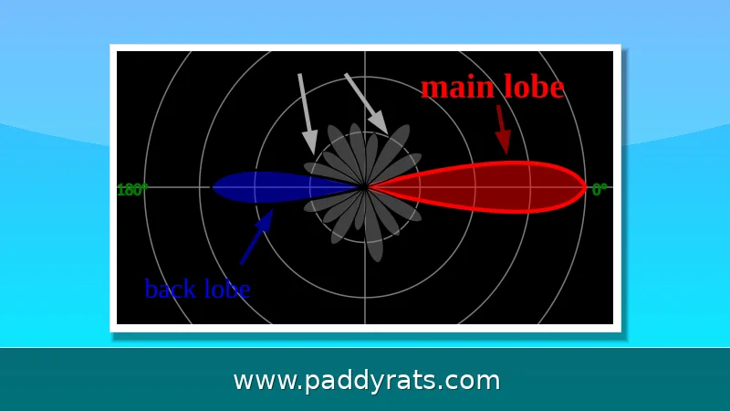
Tracking down a jammer is as much about geometry as it is about radio. CRPA (Controlled Reception Pattern Array) antennas rely on null steering to weaken interference coming from specific directions, and every station reports the azimuth, elevation, affected frequency band, and signal intensity it picks up. Once several CRPA stations spread across different locations feed in their direction data, a spatial resection paired with an adjustment model can calculate where the jammer sits — along with the uncertainty surrounding that estimate.
DLR's robust receivers with digitally steerable antennas work along the same lines: they detect the direction a signal is coming from, suppress the interferer, and then verify whether what's left is authentic. Dimetor takes the opposite approach when it comes to infrastructure — instead of adding new hardware, it taps GNSS receivers already sitting at mobile phone masts to spot interference and spoofing across wide areas. And onocoy pairs AI with community-based monitoring, essentially crowdsourcing the detection effort. A Baltic Sea shipborne study from June 23 to October 14, 2025 shows just how much detail this kind of monitoring can surface: the interference traced back to four coordinated sources — one GPS spoofer, two chirp jammers, and one broadband analog jammer — and it ran up to 15 dB stronger out on the open sea than it did in Danzig harbor.
GNSS Interference in Aviation, Maritime and Critical Infrastructure
This isn't just a theoretical problem anymore. In Q2 2025 alone, more than 10,000 vessels worldwide reported being hit by GNSS interference — that's eight times the number from just the previous quarter. A Swedish report tallied roughly 123,000 flights targeted by GNSS disturbances between January and April 2025. That same year, analysts were logging over 1,500 flights affected by GPS interference every single day, with more than 122,000 flights impacted in the first period. And out on the Baltic Sea, a shipborne study painted an even grimmer picture: GNSS availability dropped to 83.5%, with over four days of spoofing recorded and nearly 30 hours of continuous spoofing from July 1 to 3.
A separate Kaliningrad/Baltic report from June 2025 detected 84 hours of GNSS interference over six months, 29 hours of it in October alone. Beyond transport, GNSS interference affects 4G/5G synchronization, power grids, data centers, financial transactions, agriculture, and rescue services. Airport disruption alone could cost millions of euros per day, which is why early detection matters: it lets operators switch to alternative sources or abort operations safely.
Why Does GNSS Denied Performance Depend on Your Hardware?
When GNSS is denied, the fallback is inertial navigation and multi-sensor fusion — inertial sensors and cameras combined with GNSS for redundancy. Standard GNSS positioning error sits at 5–10 meters, and corrections improve that dramatically: DGNSS delivers sub-meter accuracy, SBAS around 2.5 meters (WAAS, EGNOS), RTK centimeter-level, PPP with long convergence, and PPP-RTK fast and precise. But once signals vanish, drift becomes the metric that matters.
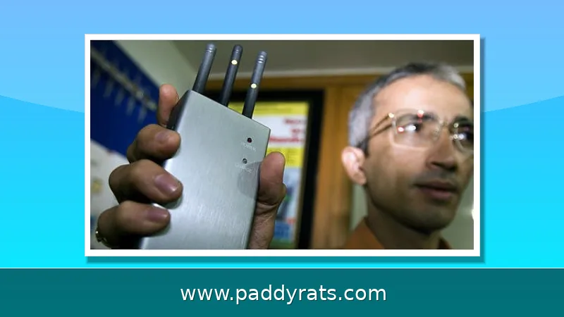
SBG Systems publishes GNSS-denied drift figures that show how much hardware choice matters: the Ellipse drifts 0.56% of distance traveled (about 30 m over 5 km), the Ekinox Micro 0.13% DT (about 7.2 m), and the Apogee roughly 2 m over 5 km. Safran NetClock typically tracks 5–10 satellites (max 12) and needs at least 4 until the initial survey, then at least 1. Small portable jammers block GNSS within a few meters to a few hundred meters, while military jammers reach several kilometers.
| Correction method | Typical accuracy |
|---|---|
| Standard GNSS | 5–10 m |
| DGNSS | Sub-meter |
| SBAS (WAAS, EGNOS) | ~2.5 m |
| RTK | Centimeter |
| PPP / PPP-RTK | Long convergence / fast and precise |
Practical Steps to Troubleshoot GNSS Reception Problems
When a receiver misbehaves, I work through a checklist before assuming an attack. Geolantis troubleshooting guidance starts with device power, then Bluetooth/Wi-Fi connection, then moving to an open area with a clear sky view and waiting for satellite lock. From there: check internet connectivity, verify NTRIP settings, and confirm RTK status, where Fixed is the best state. If the trajectory looks wrong, SBG Systems advises checking the trajectory first, then the number of outages, outage duration, and how the error is reported.
For vessels, the NATO Shipping Centre recommends monitoring alarms on the GNSS unit, ECDIS, and autopilot, and cross-checking GNSS data against other sensors. One caution from the field: single-outage GNSS-denied tests can be misleading, so repeated, statistically meaningful evaluations are needed. And remember the legal side — the sale and use of jammers is prohibited, and devices are regularly confiscated by police and customs.
Frequently Asked Questions
How can I tell if GNSS is being jammed or spoofed?
Watch the carrier-to-noise ratio (C/N0) and automatic gain control (AGC). During jamming, noise rises so C/N0 drops and AGC dips. During spoofing, a fake strong signal makes C/N0 rise while AGC still drops. Simultaneous changes in both values are a strong interference indicator.
What is the difference between GNSS jamming and spoofing?
Jamming broadcasts strong radio signals on GNSS frequencies, drowning out weak satellite signals so a receiver cannot compute position. Spoofing broadcasts fake signals that look real, tricking the receiver into computing a wrong position or time. Spoofing is technically more sophisticated than jamming.
How can a GNSS jamming source be located?
Multiple spatially distributed CRPA antennas each report the azimuth and elevation of the detected interference. Using known station coordinates, a spatial resection calculation determines the jammer position, and an adjustment model accounts for measurement uncertainty.
Why is detecting GNSS interference important for critical infrastructure?
GNSS provides position, navigation and precise timing. Interference affects aviation, maritime traffic, 4G/5G synchronization, power grids, data centers and financial transactions. Early detection lets operators switch to alternative sources or abort operations safely.